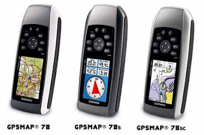
Download Garmin GPSMAP 78 Manual will familiarize you how to use the GPS properly. For those who love navigation and water sports looking for the best, the Garmin GPSMAP 78 features clear color maps, high-sensitivity receiver, molded rubber side grips and microSD card slot for extra maps. High sensitivity, WAAS technology, GPS receiver with HotFix technology. Floating device. World base map with reliefs. 2.6 "color LCD display visible in sunlight 3-axis electronic compass. (78). Barometric Altimeter (78s). High-speed USB, (78s), and NMEA 0183 output. Battery life up to 20 hours. Robust and watertight (IPX7).
 |
| Garmin GPSMAP 78 Manual |
Upload your exercise data to Garmin Connect and you will know everything Garmin have prepared for you. From uploading to analysis to exploring millions of activities around the world, there's always something waiting for you on Garmin Connect. Store all your workout data in Garmin Connect and you can perform the full analysis. Garmin Connect displays your data in a clear and simple assessment. In the coming months, Garmin will offer even more utilities that will help you optimize your workouts. Reports are a very useful way of monitoring your goals and training progress. You can make reports based on activities or events. Garmin Connect lets you create training goals and send them to your device. When you complete activities related to your goals, they will be recorded on both your device and Garmin Connect. For troubleshooting using this GPS see page 39 Garmin GPSMAP 78 Manual.
Garmin GPSMAP 78 Specs
| Technical Characteristics | High-sensitivity receiver: YesDevice interface: USB and NMEA 0183 compatibleHunting and fishing calendar: YesAstronomical information: YesTide prediction: YesCalculation of areas: YesFloating: YesCustomizable Points of Interest: YesNavigation to photos: YesAutomatic route creation (turn-by-turn): YesGeocaching mode: Yes (paperless)Screen type: transflective TFT of 65,000 colorsBattery: 2 AA batteries (not included), recommended NiMH or lithiumBattery life: 20 hoursWater Resistant: Yes (IPX7)Garmin Connect ™ compatible: Yesfor more information about features and setting see page 16 of Garmin GPSMAP 78 Manual |
| Mapping | Base Map: YesAbility to add maps: YesInternal memory: 1.7 GBWaypoints: 2000Routes: 200Track log: 10,000 points, 200 saved tracks |
| Physical Characteristics | Unit Dimensions: 6.6 x 15.2 x 3 cm (Width / Height / Depth)Screen Size: 4.1 x 5.6 cmWeight: 218.3 g with batteriesScreen resolution: 160 x 240 pixelsSupports data cards: microSD ™ card (not included) |
0 Response to "Garmin GPSMAP 78 Manual"
Post a Comment