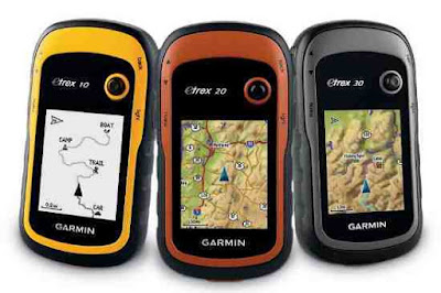
Download Garmin eTrex 20 Manual will familiarize you how to use the GPS properly. The Garmin eTrex 20 has an enhanced bright display of 2.2 and 65,000 colors, which can be read in the sunlight. Durable and water-resistant, the eTrex 20 is designed to withstand inclement weather conditions. It has an improved interface but retains the legendary resistance designed to deal with elements, whether dust, dirt, moisture or water. None of this will be an obstacle for this famous browser. With a wide range of compatible media, you can use the Garmin eTrex 20 on off-road vehicles, bicycles, boats or use it as your handheld or personal navigator in your car. Use the car mount function and City Navigator NT maps to receive turn-by-turn driving directions. The eTrex unit has all the maps and media needed to take you anywhere.
 |
| Garmin eTrex 20 Manual |
The Garmin eTrex 20 supports geocaching GPX files to download geocaches and other data directly to the drive. Visit OpenCaching.com to start your geocaching adventure. By not using paper, you are not only helping the environment, but it makes your geocaching more fun. The eTrex 20 unit stores and displays all the information you need, including location, terrain, difficulty, suggestions and descriptions, so you no longer have to enter coordinates manually or carry paper prints. Just upload the file to the drive and go out and look for caches. For customizing and system setting your GPS see page 28 of Garmin eTrex 20 Manual.
Garmin eTrex 20 Specs
| Physical Characteristics and Performance | Dimensions of unit (Width / Height / Depth): 2.1 "x 4" x 1.3 "(5.4 x 10.3 x 3.3 cm).Screen Size (Width / Height): 1.4 "x 1.7" (3.5 x 4.4 cm); 2.2 "diagonally (5.6 cm).Screen Resolution (Wide / Height): 176 x 220 pixels.Display Type: 65,000 colors transflective TFT.Weight: 5 oz (141.7 g) with batteries.Battery: 2 AA batteries (not included); NiMH or lithium recommended.Battery life: 25 hours.Water Resistant: Yes (IPX7).Floating: No.High Sensitivity Receiver: Yes.Computer interface: USB. |
| Maps & Memory | Base map: YesPreloaded maps: NoAbility to add maps: YesInternal Memory: 1.7 GBSupports data cards: microSDTM card (not included)Waypoints: 2000Routes: 200Track log: 10,000 points, 200 saved tracks |
| Features | Automatic route creation (turn-by-turn): Yes (with optional maps with detailed road information).Compass: NoBarometric Altimeter: NoCustom maps compatible: YesNavigation towards photos: YesAstronomical Information: YesCalculation of areas: YesTransfer from unit to unit (shares data with similar units wirelessly): NoPicture Viewer: YesGarmin ConnectTM compatible (online community where you can analyze, classify and share data): Yes |
0 Response to "Garmin eTrex 20 Manual"
Post a Comment